WEATHER ALERT
ENVIRONMENT CANADA
*************************
Winter Storm Watch in effect for:
- Sault Ste. Marie - St. Joseph Island
- Searchmont - Montreal River Harbour - Batchawana Bay
Some snow today, then a winter storm tonight into Saturday.
Hazards:
Today:
Snowfall accumulations of 5 to 10 cm.
Tonight into Saturday:
Snow and ice pellet accumulations of 20 to 30 cm.
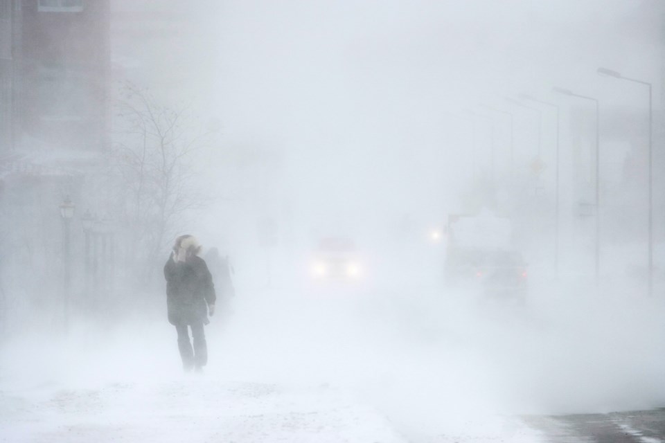
Reduced visibility due to heavy snow and blowing snow.
Freezing rain with ice accretion of 2 to 3 mm possible.
Strong wind gusts up to 60 km/h.
Timing:
Snow this morning into the late afternoon.
Winter storm overnight tonight into Saturday afternoon.
Discussion:
Two weather systems will affect the area over the next two days. The first will move through today bringing 5 to 10 cm of snow. There will then be a brief break in the precipitation this evening before a second and much stronger system moves in overnight tonight. Depending on the track of the system, some areas will see heavy snowfall while others will receive significant ice accretion. Strong winds are also expected, and combined with any ice accretion could produce utility outages.
There remains some uncertainty at this point to the placement of the heaviest snow and freezing rain. Warnings may be issued as the event draws nearer.
Rapidly accumulating snow could make travel difficult over some locations. Visibility may be suddenly reduced at times in heavy snow. Surfaces such as highways, roads, walkways and parking lots may become icy and slippery.
Public Safety Canada encourages everyone to make an emergency plan and get an emergency kit with drinking water, food, medicine, a first-aid kit and a flashlight. For information on emergency plans and kits go to http://www.getprepared.gc.ca.
Please continue to monitor alerts and forecasts issued by Environment Canada. To report severe weather, send an email to [email protected] or tweet reports using #ONStorm.
*****
Special Weather Statement in effect for:
- Agawa - Lake Superior Park
Heavy snow possible tonight into Saturday.
Hazards:
Snowfall accumulations of 5 to 15 cm.
Reduced visibility due to heavy snow and blowing snow.
Timing:
Overnight into Saturday afternoon.
Discussion:
A winter storm will move through northeastern Ontario overnight into Saturday. A sharp boundary of heavy snow is expected, and depending on the track of the system some areas may receive snowfall accumulations of 15 cm or more while other areas receive far less.
There remains some uncertainty at this point to the placement of the heaviest snow. Warnings or winter weather travel advisories may be issued as the event draws nearer.
Rapidly accumulating snow could make travel difficult over some locations.
Public Safety Canada encourages everyone to make an emergency plan and get an emergency kit with drinking water, food, medicine, a first-aid kit and a flashlight. For information on emergency plans and kits go to http://www.getprepared.gc.ca/
Please continue to monitor alerts and forecasts issued by Environment Canada. To report severe weather, send an email to [email protected] or tweet reports using #ONStorm.
*************************