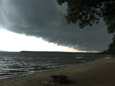
Faithful SooToday.com reader Diane Lajambe snapped this photograph Saturday afternoon at approximately 4 p.m. as a nasty, yet brief storm-front rolled through the Batchawana Bay area.
See the photo gallery below for more of Lajambe's wicked weather shots.
The last two shots in the gallery were provided by David Hammond, who was at Sand Bay when the storm passed through.
According to the latest Environment Canada forecast, Sault Ste. Marie should prepare for another damp weekend.
************************* Tonight
A few clouds. Wind northwest 30 km/h becoming light this evening. Low 8.
Wednesday
A mix of sun and cloud. High 19. UV index 7 or high.
Wednesday night
Cloudy periods. Low 8.
Thursday
A mix of sun and cloud. High 20.
Friday
Sunny. Low 6. High 22.
Saturday
Showers. Low 10. High 21.
Sunday
Cloudy with 30 percent chance of showers. Low 15. High 24.
Monday
A mix of sun and cloud with 30 percent chance of showers. Low 13. High 21.
*************************