A major snowstorm is expected to blow well north of Sault Ste. Marie this afternoon and evening, slamming a broad swath across Northern Ontario from the Manitoba to Quebec borders.
Environment Canada has issued the following winter storm warning for Wawa - Pukaskwa Park - White River - Dubreuilville - Kapuskasing - Hearst - Smooth Rock Falls and many other areas.
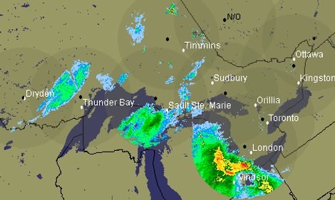
The radar image shown was current as of 8:30 a.m.
We've also included a special weather statement issued by the U.S. National Weather Service.
*************************** Environment Canada
An intense Colorado low pressure system is expected to sweep across the Great Lakes this evening and move through central and Northern Ontario by Wednesday morning.
In general, snowfall amounts of 25 to 40 centimetres are expected with this storm especially along a swath extending from northwestern shores of Lake Superior to Kapuskasing.
Extensive blowing and drifting snow are also forecast giving near blizzard conditions at times.
Heavy snowfall will start tapering off from the Thunder Bay Atikokan and vicinity regions overnight and from the rest of the warned regions Wednesday morning.
*************************** U.S. National Weather Service
CHIPPEWA - MACKINAC - EMMET - CHEBOYGAN - PRESQUE ISLE -CHARLEVOIX - ANTRIM - OTSEGO - MONTMORENCY - ALPENA -KALKASKA - CRAWFORD - OSCODA - ALCONA - WEXFORD - MISSAUKEE - ROSCOMMON - OGEMAW - IOSCO - INCLUDING THE CITIES OF SAULT STE. MARIE, ST. IGNACE, PETOSKEY, CHEBOYGAN, ROGERS CITY, CHARLEVOIX, MANCELONA, GAYLORD, ATLANTA, ALPENA, KALKASKA, GRAYLING, MIO, HARRISVILLE, CADILLAC, LAKE CITY, HOUGHTON LAKE, WEST BRANCH. TAWAS CITY
WINTRY MIX OF PRECIPITATION EXPECTED THIS MORNING.
AN AREA OF PRECIPITATION WILL ADVANCE ACROSS MUCH OF NORTHERN MICHIGAN THROUGH THE MORNING HOURS.
MEANWHILE, SURFACE TEMPERATURES WILL REMAIN AT OR BELOW FREEZING IN MANY AREAS, INCREASING THE POTENTIAL FOR A WINTRY MIX OF SNOW, SLEET AND FREEZING RAIN.
THE BEST CHANCE FOR WINTRY PRECIPITATION WILL BE FOUND ROUGHLY ALONG AND NORTH OF A LINE FROM KALKASKA TO HOUGHTON LAKE TO OSCODA.
TRAVEL CONDITIONS WILL LIKELY BECOME SLIPPERY THIS MORNING, BEFORE TEMPERATURES SLOWLY CLIMB ABOVE FREEZING TOWARD THE LUNCH HOUR.
USE CAUTION IF TRAVELING THIS MORNING.
*************************