Kirk Dillabough of the Ontario Ministry of Natural Resources has released the following observations from its helicopter reconnaisance of the Goulais River on Sunday afternoon:
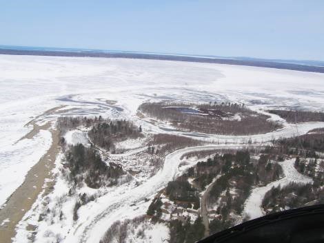
************************* - The mouth (shown) shows signs that it may start to open up.
- From the mouth upstream to Grant’s Landing the ice is still fairly solid.
- From Grant’s Landing to approximately three kilometres upstream of the Highway 17 North bridge there are alternating areas of open water and areas of large broken ice sheets.
- From 3 kilometres upstream of the Highway 17 North Bridge there is a 1.5-kilometre stretch of smaller broken ice.
- The river is open from this point through Kirby’s Corners to approximately the Ranger Lake Road turnoff.
- From the Ranger Lake Road turnoff up to the old sawmill in Searchmont the ice is more solid in appearance.
- Upstream of the Searchmont Bridge on Highway 556 the river is open.
- The flows midway between Searchmont and Kirby’s Corners are faster, which is indicative of spring runoff.
- This may increase water levels in the community of Goulais River over the next day.
*************************