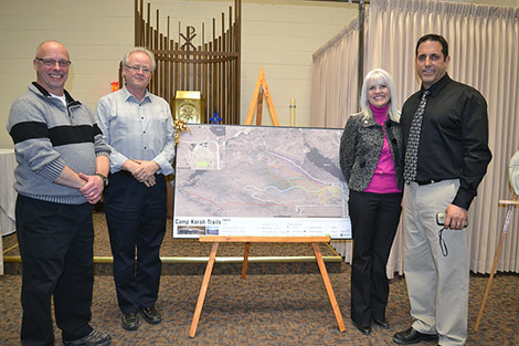
(Pictured Left to Right: Steve Baum Outdoor Education Teacher, HSCDSB Chair Lindsay Liske, HSCDSB Vice-Chair Leslie Cassidy-Amadio, Greg Sicoly Eco-Edventure Program Teacher)
NEWS RELEASE
Students in the Eco-Edventure Program at Camp Korah spent almost two months walking the trails on the 180-acre site using global positioning system (GPS) units to record the trail system in detail.
In collaboration with the Sault Ste. Marie Innovation Centre and Sault College the students gathered precise coordinates to allow for the creation of a comprehensive map highlighting the trails and significant Camp Korah landmarks.
“I am very proud of the students. They were very engaged in this project and it showed in the final product. They listened carefully to the instructions from our community partners and in the end saw just how important their contribution was to the finished product,” said Eco- Edventure Program Teacher, Greg Sicoly.
The team of Nathan Bernard, Cody Dias, Collin DiMicoli, Carson Lambert and J.P. St. Louis initially had to learn what GPS was and then how to program the recorder units.
Once the students familiarized themselves with the GPS unit functions, two staff members from the Innovation Centre spent three days with the students to walk them through the process of creating a site map.
After the information was gathered, the same duo used the Geographic Information Systems (GIS) computer lab at Sault College to create the finished product.
The significance of this project is twofold.
First, for the first time in over forty years Camp Korah has a detailed trails map that can be used for educational and recreational purposes.
And second, it has created connections with two major local entities in the field of new technologies.
*************************