SPECIAL WEATHER STATEMENT
ENVIRONMENT CANADA
*************************
Snow squall watch issued for:
- Sault Ste. Marie - St. Joseph Island
Current details:
Snow squalls are expected to develop.
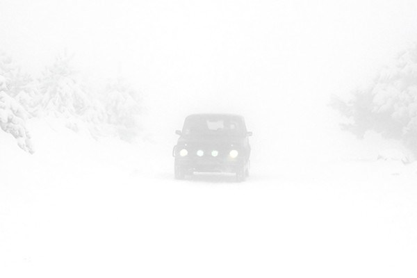
Under the snow squall bands, visibilities will be significantly reduced due to the heavy snow combined with blowing snow, and snow will quickly accumulate.
A few flurries are expected this evening however some more intense snow squall bands may develop overnight and move from north to south across the region.
Visibilities near zero in snow or blowing snow and snowfall accumulations of 10 to 15 centimetres are possible by Friday morning.
Snow squalls cause weather conditions to vary considerably; changes from clear skies to heavy snow within just a few kilometres are common.
Visibility may be significantly and suddenly reduced to near zero. Road closures are possible.
Please continue to monitor alerts and forecasts issued by Environment Canada.
To report severe weather, send an email to [email protected] or tweet reports to #ONStorm.
*************************