Environment Canada has issued the following winter storm watch for Sault Ste. Marie - St. Joseph Island - Searchmont - Montreal River Harbour - Batchawana Bay - Agawa - Lake Superior Park - Wawa - Pukaskwa Park - White River - Dubreuilville.
It's followed by a hazardous weather outlook issued earlier today by the U.S. National Weather Service for much of Northern Michigan, including Chippewa County.
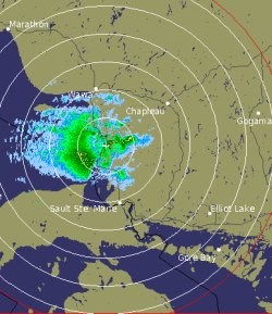
The Environment Canada radar image shown was taken at 11 p.m.
************************* Environment Canada
Potential for significant snowfall Tuesday and Tuesday night.
This is an alert to the potential development of dangerous winter weather conditions in these regions.
Monitor weather conditions. Listen for updated statements.
Another Colorado low is developing tonight and has its sights set on the Great Lakes for Tuesday and Wednesday.
Snow ahead of the system will overspread many parts of central and northeastern Ontario on Tuesday and continue through Tuesday night into Wednesday.
Currently areas north of Sault Ste. Marie and south of Wawa are being impacted by heavy flurries and a few local snow squalls that could give an initial 10 centimetres ahead of the system snow due to arrive Tuesday.
The system snow will be the most intense where onshore southerly winds pick up enhanced moisture off of Lake Superior.
This will particularly affect the snow-belt corridor from north of Sault Ste. Marie along Highway 17 through Wawa and to the north of Lake Superior.
Snow will fall heavily at times Tuesday and Tuesday night with potential additional accumulations of 15 to 20 centimetres.
Locally higher amounts are possible.
Brisk winds at times will create some blowing and drifting of the snow as well.
This watch may be upgraded to a warning as the snowfall amounts become more certain.
************************* U.S. National Weather Service
THIS HAZARDOUS WEATHER OUTLOOK IS FOR NORTHERN LOWER MICHIGAN, EASTERN UPPER MICHIGAN AND ADJACENT NEARSHORE WATERS OF LAKE MICHIGAN, LAKE HURON AND LAKE SUPERIOR.
DAY ONE - TONIGHT
NO HAZARDOUS WEATHER IS EXPECTED AT THIS TIME.
DAYS TWO THROUGH SEVEN - TUESDAY THROUGH SUNDAY
SNOW WILL DEVELOP TUESDAY MORNING, AND CONTINUE INTO THE EVENING HOURS WITH MODERATE ACCUMULATIONS EXPECTED.
LOCALLY HEAVY SNOW IS POSSIBLE IN WESTERN MACKINAC COUNTY, ALONG WITH BLOWING AND DRIFTING SNOW.
ANOTHER ROUND OF SNOW WILL OCCUR ON WEDNESDAY.
THIS STORM HAS THE POTENTIAL TO PRODUCE HEAVY SNOW, ESPECIALLY IN NORTHERN LOWER MICHIGAN.
*************************