The following snowfall warning has been issued late Christmas Eve by Environment Canada for Sault Ste. Marie - St. Joseph Island- Searchmont - Montreal River Harbour - Batchawana Bay - Agawa - Lake Superior Park - Blind River - Thessalon - Manitoulin Island - Espanola - Killarney - Elliot Lake - Ranger Lake - Gogama - Foleyet - Chapleau - Missinaibi Lake.
Similar warnings are in effect for the Sudbury, North Bay and Kirkland Lake - New Liskeard - Temagami regions.
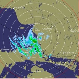
The radar image shown was taken at 10:20 p.m. today.
We've also included a winter weather advisory issued tonight by the U.S. National Weather Service.
************************* Environment Canada
Significant snowfall continues tonight.
The centre of the Colorado winter storm has passed through Ontario and is now over southwestern Québec.
It will continue to track northeastward pulling away from our regions.
The snow associated with it will continue through the evening before tapering off to isolated flurries overnight.
Snowfall is expected to be at times heavy for portions of the warned regions this evening, especially for North Bay and its vicinity.
For those regions under the snowfall warning, total snowfall amounts of 15 to 20 centimetres are likely before the snow tapers to flurries overnight.
************************* U.S. National Weather Service
LAKE EFFECT SNOW AND BLOWING SNOW CONTINUES OVERNIGHT.
AS LOW PRESSURE PULLS AWAY FROM THE REGION TONIGHT, LAKE EFFECT SNOW SHOWERS WILL DEVELOP ACROSS NORTHWEST LOWER AND EASTERN UPPER MICHIGAN.
ALTHOUGH SIGNIFICANT AMOUNTS OF ADDITIONAL SNOWFALL ARE NOT EXPECTED, NORTHWEST WINDS GUSTING UP TO 35 MPH WILL CREATE AREAS OF BLOWING AND DRIFTING SNOW.
EXPECT SHARPLY REDUCED VISIBILITIES IN OPEN AREAS AND ALONG THE LAKE SHORELINES OVERNIGHT.
TRAVEL OVERNIGHT IS STILL EXPECTED TO BE SIGNIFICANTLY IMPACTED, SO PLAN ACCORDINGLY.
CHIPPEWA - INCLUDING THE CITY OF SAULT STE. MARIE
THE WINTER WEATHER ADVISORY IS NOW IN EFFECT UNTIL 5 AM EST THURSDAY.
LAKE EFFECT SNOW IS EXPECTED TO CONTINUE THROUGH THE OVERNIGHT HOURS, WITH AN ADDITIONAL 1 TO 3 INCHES OF ACCUMULATION EXPECTED BY EARLY CHRISTMAS MORNING.
THE HEAVIEST SNOW AMOUNTS WILL FALL WEST OF I-75 AND NORTH OF M-72, IN THE FAVORED LAKE EFFECT AREAS.
IN ADDITION - WINDS GUSTING UP TO 35 MPH - WILL CREATE AREAS OF BLOWING AND DRIFTING SNOW.
EXPECT SHARPLY REDUCED VISIBILITIES - ESPECIALLY ALONG THE IMMEDIATE LAKE SUPERIOR AND WHITEFISH BAY SHORELINES.
WINDS WILL SUBSIDE EARLY CHRISTMAS MORNING.
A WINTER WEATHER ADVISORY FOR SNOW MEANS THAT PERIODS OF SNOW WILL CAUSE TRAVEL DIFFICULTIES.
BE PREPARED FOR SNOW-COVERED ROADS AND LIMITED VISIBILITIES AND USE CAUTION WHILE DRIVING.
*************************