The best route for trucks travelling to and from the International Bridge is along Queen, Hudson and John Streets, according to an inch-thick environmental assessment to be presented to City Council on Monday night.
The new route, expected to carry a total construction cost of almost $11 million, will channel truck traffic through a residential area on Hudson Street, but the plan is to buy all homes there for road expansion and to alleviate property-owner concerns.
The Queen/Hudson/John route had the least effect on residential areas of the 20 other potential routes considered in the study, but residents of Hudson Street have made it clear they don't want to live along a truck route.
Included in the proposed new route is a new northern extension to Hudson Street, allowing a more efficient way to access Second Line instead of using Conmee and John.
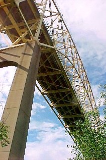
Realignment of Highway 17
The study, conducted by Toronto-based Read, Voorhees & Associates and Mississauga-based UMA Engineering, was commissioned as part of the City of Sault Ste. Marie's development of a transportation master plan, which is needed, among other things, to consider how to route truck traffic between the bridge and a proposed realignment of Highway 17.
The Ontario Ministry of Transportation intends to reroute Highway 17 East so it connects to the City road system in an extension of Second Line at Black Road.
That's expected to cut traffic loads on Trunk Road, Wellington Street and Black Road, increasing the load on Second Line.
Why the status quo isn't working
At present, trucks are routed through several residential neighbourhoods and the downtown shopping and business area.
"The existing truck route system has long been considered inadequate," the consultant said.
Wellington Street between Trunk Road and East Street is narrower than most thoroughfares, resulting in sideswipe collisions involving trucks and other vehicles.
Snow-packed curb lanes
"In the winter," the consultant said, "the situation is even worse because there is a limited area for snow storage due to the narrow boulevards between the curb and the sidewalk. Snow is temporarily stored on the edge of the curb lane. As a result, the curb lane becomes even narrower, causing more problems for traffic."
Other problems include insufficent space for trucks to turn at many intersections, traffic congestion, and the Soo's many hills, which significantly increase the time needed for trucks to stop or accelerate.
Truck traffic has been increasing in recent years and is expected to grow further because of the casino and the proposed Gateway development.
One crow, one seagull, one butterfly, maybe a beaver
The study considered effects of the proposed truck routes on the natural environment, socio-economic development, archeological and heritage sites, cultural activities, public safety, as well as the financial implications.
It concluded there were few environmental implications to the new route. The proposed extension of Hudson Street is through what appears to be an old landfill site containing asphalt, concrete, gravel, shingles and scrap metal, as well as steel plant waste including slag.
The property was apparently low-lying or swamp land where construction materials and manufacturing waste were used as fill.
Wildlife observed during an inspection of the area were limited to one seagull, one crow, and one Mourning Cloak butterfly. "There may be a beaver living in the ditch," the consultant said.
$10.9 million price tag
Total construction costs are estimated at $10.9 million, of which $5.9 million is to build new road extensions and widen existing sections.
$2.4 million is earmarked for road construction costs, and $3.5 million for acquiring property.
The construction would allow the City to replace sanitary and storm sewers in the area.
Homes to be demolished
"The design is based on the removal of all the residences along Hudson Avenue between St. Andrews Terrace and Conmee Avenue," the consultant said.
$1.26 million is allocated for property acquisition for St. Andrews Terrace to Wellington Street.
$2 million is earmarked to acquire properties from Wellington Street to Conmee Avenue.
The plan also includes $15,000 to acquire a new roadway beside the ACR line from Queen Street to St. Andrews Terrace, and $278,000 for land for a new roadway from Conmee Avenue to John Street.
60 km/h speed limit
Here are some of the consultant's descriptions of the new route:
"The truck route has been designed with two lanes south of Wellington Street where much of the traffic will be trucks, and four lanes north of Wellington Street where considerable automobile traffic will join the trucks."
"The design is based on removal of all the residences along Hudson Street between St. Andrews Terrace and Conmee Avenue. South of Wellington Street the residences will be removed as a mitigation measure related to noise. North of Wellington Street the residences will be removed, partly to allow the extra-wide cross-section to be constructed and partly as a mitigation measure. The cost of noise barriers along the developed section of the truck route where feasible (Queen Street to Conmee Avenue) has been included."
The speed limit on the new route will be 60 km/h.
Study includes outdated data
The study contains one obviously outdated assumption.
It cites the 1996 federal census population of 80,054 for Sault Ste. Marie, adding that "the population is expected to change very little in the foreseeable future."
As SooToday.com was first to report last week, the latest figures from the 2001 census show the Soo's population has dropped 6.9 percent. We now have just 74,566 inhabitants.
What happens now?
Copies of the environmental study report can be viewed at the City Clerk's office on the fourth floor of the Civic Centre, and at the Sault Ste. Marie Public Library.
For the next 30 days, the City will receive comments from interested parties and the public.
Any changes made as a result of this input will be added to the report.
If significant concerns remain, concerned individuals or groups may ask the Minister of the Environment to require a more extensive environmental review.
Completion slated for 2007
Otherwise, the project may proceed to detailed design and construction after the 30-day review period.
The timeline supplied with the latest report shows design work to be completed in 2002, and construction to be finished prior to 2007, when the new Highway 17 is expected to be finished.
To receive free, real-time Email updates of SooToday.com's exclusive coverage of local news, just send an Email with "SUBSCRIBE" in the subject line to [email protected].
This free service is provided courtesy of the community-minded businesses whose advertisements appear on these pages.