NEWS RELEASE
MINISTRY OF NATURAL RESOURCES
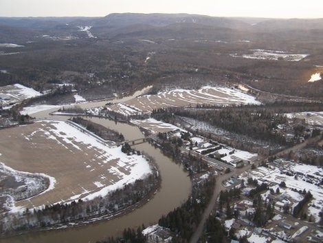
************************** Based on observations made by Kirk Dillabough through an aerial survey conducted this morning, the Ministry of Natural Resources would like to report that the ice jam that was located in the lower Goulais River has pushed its way down the river.
The ice appears to have worked its way under the ice sheet into Goulais Bay.
The risk of flooding is characterized as low, as water levels and flows continue to drop.
The Ministry of Natural Resources will continue to monitor the river through its sensors located at Searchmont and Kirby’s Corners to track the snow melt and run off.
No further media releases will be done unless we experience a big runoff and rain event.
************************* To view aerial photos of the Goulais River taken this morning, please click on the photo gallery below.