The U.S. National Weather Service has issued the following winter storm watch for parts of northern Michigan, including Chippewa County and the Michigan Soo.
An Environment Canada rainfall warning has been issued for Manitoulin Island - Espanola - Killarney.
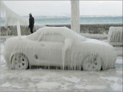
Similar freezing rain warnings are in effect for other parts of Northern Ontario.
************************* U.S. National Weather Service
BLAST OF COLD AIR AND GUSTY WINDS LATE IN THE WEEKEND
AFTER A WARMER AND WET SATURDAY, SUBSTANTIALLY COLDER AIR WILL SURGE BACK INTO THE REGION SUNDAY MORNING ON GUSTY WEST TO NORTHWEST WINDS.
MODERATE TO POSSIBLY HEAVY SNOW IS EXPECTED ON SUNDAY WITH NEAR BLIZZARD CONDITIONS POSSIBLE.
CHIPPEWA - MACKINAC - EMMET - CHEBOYGAN - CHARLEVOIX - LEELANAU - ANTRIM - BENZIE - GRAND TRAVERSE - INCLUDING THE CITIES OF SAULT STE. MARIE, ST. IGNACE, PETOSKEY, CHEBOYGAN, CHARLEVOIX, NORTHPORT, MANCELONA, FRANKFORT, TRAVERSE CITY
A WINTER STORM WATCH REMAINS IN EFFECT FROM SUNDAY MORNING THROUGH SUNDAY AFTERNOON.
RAIN WILL CHANGE OVER TO SNOW EARLY SUNDAY MORNING AND MAY BECOME HEAVY AT TIMES THROUGH THE DAY.
STRONG AND GUSTY WINDS MAY LEAD TO EXTENSIVE BLOWING AND DRIFTING SNOW.
EXPECT BETWEEN 4 AND 7 INCHES OF ACCUMULATION WITH NEAR BLIZZARD CONDITIONS POSSIBLE.
A WINTER STORM WATCH MEANS THERE IS A POTENTIAL FOR SIGNIFICANT SNOW, SLEET, OR ICE ACCUMULATIONS THAT MAY IMPACT TRAVEL.
************************* Environment Canada
Significant rain starting tonight and ending Saturday night.
A significant weather system over the American midwest is tracking northeastward toward Ontario.
This system will bring widespread precipitation to much of Northern Ontario beginning tonight.
While the precipitation will begin as snow for most locales, it is expected to change over to rain by morning in all areas except parts of the Northwest.
Freezing rain warning
Prior to the changeover from snow to rain many regions could experience some patchy freezing drizzle or freezing rain resulting in local ice accretions on untreated surfaces.
Regions in a rough swath from Atikokan through Lake Nipigon and eastward toward Kapuskasing and Timmins are expected to receive more freezing precipitation than other locales and thus a freezing rain warning has been issued for these areas.
A few millimetres of ice accretion on untreated surfaces may result.
Primarily during the late evening and overnight hours.
Rainfall warning
For portions of the Nickel Belt some patchy light snow this evening will quickly change over to an extended period of rain.
Periods of rain are expected to continue through Saturday before ending toward dawn Sunday.
Current indications suggest that the area from Manitoulin Island northeastward through Killarney, Sudbury and North Bay could receive between about 25 and 50 millimetres of rainfall in total by Sunday morning.
Additionally temperatures will continue to rise tonight, climbing to near 10 by Saturday morning.
These relatively high temperatures will accelerate melting of the existing snow pack and compound drainage and runoff concerns.
Environment Canada continues to monitor this developing situation.
*************************