Perhaps one of the areas best-kept secrets as of late is the existence and development of the Ojibway Park Nature Trail.
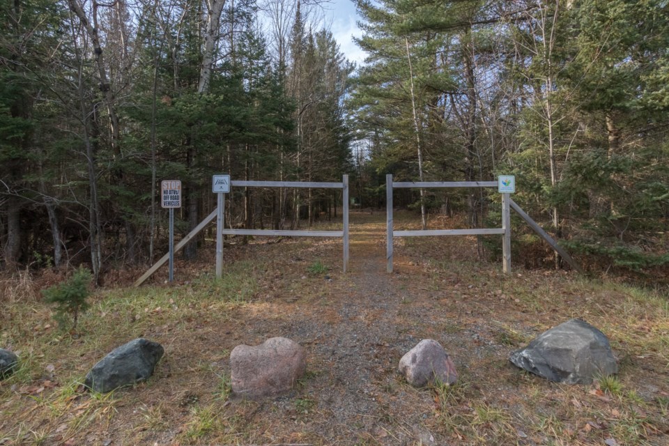
The current Ojibway Park Trail is two kilometres in length situated in a wonderfully quiet location filled with wetlands and forested area, the trail is mainly flat, solid and well-drained to dry.
"Ojibway Park was originally set aside for the women and children of Garden River First Nation as a traditional site for harvesting medicinal plants and vegetation. Ojibway Park was eventually classified as a Sensitive Area due to the natural features and ecological function of such significance that warranted their protection. In 1962, Ojibway Park campground officially opened as a public camping facility.
In 2016, the development of the 2-kilometre granular trail began throughout the westerly portion of Ojibway Park and remains light, focusing on the preservation of natural aquatic and land ecosystems. The Economic Resource and Community Development Unit (under Garden River First Nation) has been focusing on nature trail enhancement in this section of the Park; the main priority ensures the trail serves as an educational experience for all Garden River First Nation (GRFN), its members and to the general public in the future as it relates to the Ojibway culture, language and traditions while protecting the sensitive area.
The 2km trail, is a loop off of the Trans Canada Trail that traverses through the Garden River First Nation. Trans Canada Trail stretches for nearly 27,000 kilometres throughout Canada, and Garden River First Nation is proud to be part of that network," said Cheyenne Nolan, Supervisor, Capacity Development, GRFN and Darlene Solomon, Manager, Economic Resource and Community Development, GRFN in a recent email interview.
I have walked this trail personally a few times already and can attest to its beauty, and ease of use. For the most part, I would rate it as easy due to the relative flatness and granular surface. Most high water spots have been amended to allow for drainage with either pipes or boardwalks. For the most part, excluding times of year when you must allow extra time for drainage, you can pretty much traverse in shoes. There are a few areas a little water still sits.
"The Economic Resource and Community Development department partnered with Wikwemikong Tourism and their Trail Building Team. In 2016, Wikwemikong Trail Builders provided a Trails Training course with the Ontario Parks Association to train four maintenance staff in trail construction to assist in building a Mechanized Hybrid Trail on two kilometres of granular trail as part of the Trans-Canada Trail System. Wikwemikong Trail Building Team built the 75-meter boardwalk within the trail in October 2020. " said Nolan.
The trail is located at the easternmost undeveloped portion of GRFN. Both on and off the land the location has proven to be home for many species including (but not limited to) moose, Bald Eagle, Peregrine Falcon, Eastern Meadowlark, Lake Sturgeon, Hills Thistle, Houghton’s goldenrod and the Blanding’s turtle.
"All these species are identified as species at risk according to the Endangered Species Act that took effect in 2008. Ojibway Park completed a Natural Heritage Study Report documenting all species of vegetation, birds, mammals, reptiles, amphibians, and invertebrates.
By capturing the history, sensitive areas, culture and traditions of our people as it relates to species and natural heritage, this will provide the users greater understanding and is opening up that opportunity to learn more from one another," added Nolan.
There are still some 400 meters of trail to be developed. The future plan is to make the connection to the campground. Visitors will be able to continue along a granular path to an arched bridge that crosses over a small wet area and connects with the trail to the scenic lookout point over raised and elevated boardwalks which protect the wetland area. There is narrative signage at the scenic lookout point which offers serene views of Lake George.
There are also further plans to provide a full user experience in the eco-tourism trail by enhancing the narrative signage throughout the park.
"By capturing the history, sensitive areas, culture and traditions of our people as it relates to species and natural heritage we will provide users greater understanding and open up that opportunity to learn more from one another. Further, by revitalizing the connection to the scenic lookout, will allow for the trail to connect directly into the campground and shoreline to see the natural beauty that our First Nation land and water brings," explained Nolan.
Ojibway Park is a member of the Great Lakes Waterfront Trail which is a signed route connecting 155 communities and First Nations along the Canadian shores of the Great Lakes region. It is a signature project of the Waterfront Regeneration Trust, a charity committed to protecting, connecting and celebrating the world’s largest body of freshwater.
The very first time I accessed the trail I was greeted by a Roughed Grouse displaying. I'm pretty positive this will be a promising location for birders, nature lovers, runners, walkers, cyclists and hikers alike.
Please practice responsible stewardship while accessing this trail. No ATVs or motorized vehicles are allowed on the trails, take all refuse back out with you and remember to pick up after your pet. We should all consider supporting such a wonderful resource located so close to home and preserve it for generations to come.