 FOREST FIRE UPDATE
MINISTRY OF NATURAL RESOURCES
Thus far today, there have been 13 new fires in the Northeast Region.
There are currently 42 active fires in the region, burning a total of 28249.4 hectares.
The following is an update on the larger fires in the area.
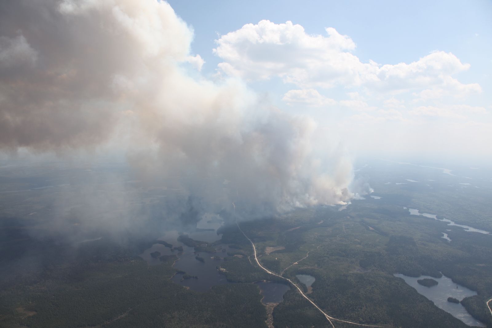
Timmins 9 (shown)
Timmins 9, north of Gogama is currently mapped at 21088 hectares in size.
The fire has increased in size, however smoke has restricted visibility not allowing aircraft to remap the size of the fire.
The fire is exhibiting extreme behaviour due to high winds.
Conditions are changing quickly and it expected that the fire will continue to grow.
Smoke and ash will affect the City of Timmins and surrounding areas.
Values protection continues on the fire by FireRanger crews, and 500 sprinklers have been installed on values.
Fire crews continue to arrive on this fire daily to assist with efforts.
An MNR incident management team is also on-site.
The safety of the public and our crews is our top priority.
The municipality of Timmins has declared a state of emergency.
Mattagami First Nation evacuated on Wednesday as a precautionary measure for the health a nd safety of residents of the community.
Due to variable winds and the risk of smoke in the area, the areas south of Hydro Bay to north of Lamotte Lake Road are currently being evacuated.
This includes the areas east of Kenogamissi.
This does not include Hydro Bay proper; however this area should be on alert. Smoke alerts are in effect for Gogama and Timmins.
Elderly persons and people affected by asthma or respiratory illnesses should take necessary precautions.
Kirkland Lake 8
Kirkland Lake 8 is currently 2757.0 hectares in size.
Five helicopters worked on the fire today, as well as FireRangers continuing values protection on values in the area.
Crews also continue to check on values protection already in place.
The Municipality has closed Goldthorpe road,
Goodfish road and restricted access to both areas.
An Implementation order was approved on May 21st for a MNR District emergency area order.
Evacuations that were previously in place remain at this time.
The municipality has made arrangements for evacuees to stay at the Kirkland Lake Royal Canadian Legion, while some evacuees are making arrangeme nts with family or friends.
The town of Kirkland Lake has been running radio ads with fire information and town evacuation updates.
Kirkland Lake 13
Kirkland Lake 13, a new fire today is currently 50 hectares in size.
The fire is 5km south west of highway 65.
People have been evacuated from Golden Eagle camp, and values protection is occurring tonight.
Heavy equipment is also working on the fire.
**For information regarding evacuation and road closures in the Kirkland Lake area, please call the Kirkland Lake Municipal Office at 705-567-9365 ext. 221.
For highway closure information, please call 511 or 1-800-268-4686.
To date, there have been 189 fires in the Northeast Region, having burnt 28751.2 has.
Evacuation/road closures, Kirkland Lake Municipal Office 705-567-9365 X221
Smoke and health related questions: Telehealth Ontario 1-866-797-0000
MTO Highway Closure Number: 1-800-268-4686, option 2 or dial 511
Map of Current Fires in Ontario
Active Fires in Table Format
Fire Hazard
A Restricted Fire Zone is currently in effect for the Northeast Fire Region, north of the French River including French River Provincial Park.
The restricted fire zone includes the MNR districts of Sudbury, North Bay, Sault Ste. Marie, Timmins, Kirkland Lake, Hearst, Chapleau, Wawa, Cochrane and Manitoulin Island.
No open burning, inc luding campfires is permitted within the boundaries of a restricted fire zone.
Portable heaters or propane stoves may be used for cooking and warmth but must be handled with extreme caution.
All burning permits are suspended.
For up to date information on the current status of the Restricted Fire Zone, please call the Northeast Region Restricted
Fire Information Hotline at 1-866-357-8422.
For photos and video of current fires, please see
https://www.box.com/s/
https://www.box.com/s/
https://www.box.com/s/
https://www.box.com/s/
Restricted Fire Zone Information
Be FireSmart! For more information, visit ontario.ca/fireprevention and report forest fires using the toll-free reporting number: 310-FIRE (3473).
*************************