 FOREST FIRE UPDATE
Current forest fire update (1900 hrs)
It has been a busy day across the Northeast Region with nine new fires thus far all requiring support from Air Attack.
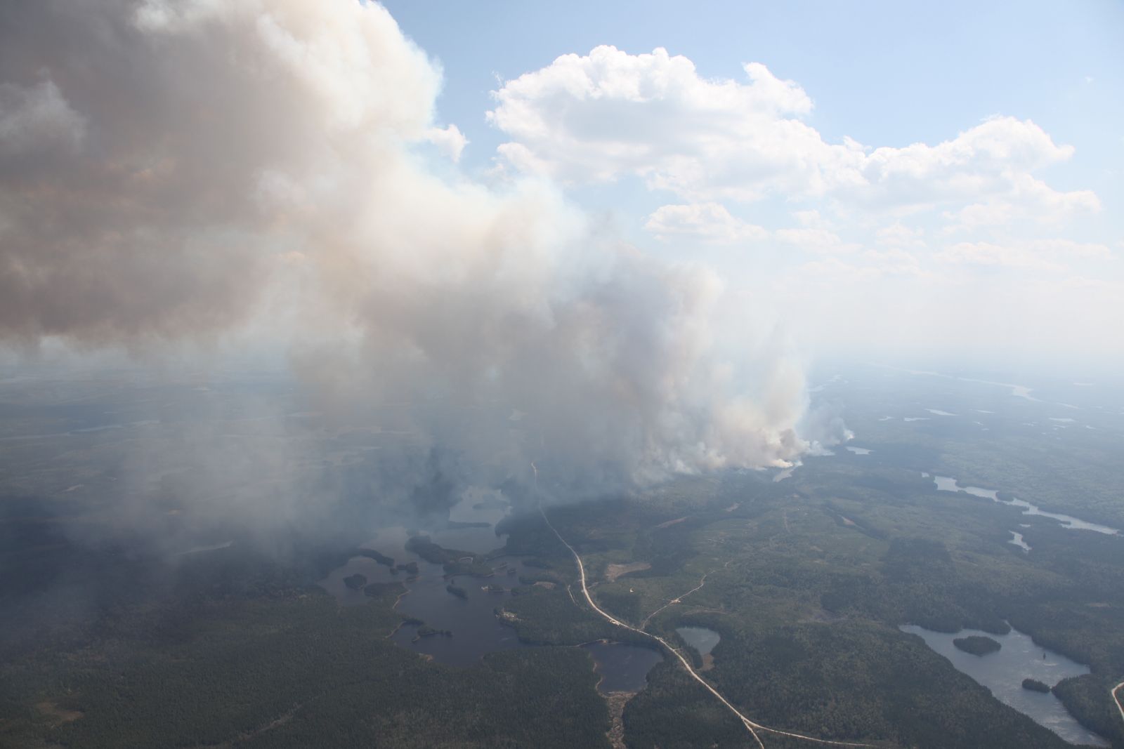
The largest fire at this moment is TIM 9 (shown) at 21088 hectares.
There are currently 45 actives fires in the region, burning a total of 28250 hectares.
The following is an update on the larger fires in the area.
Timmins 9
Timmins 9 is currently 21088 hectares in size and is north of Gogama.
An Incident Management Team is now on site to assist with efforts on this fire.
Waterbombers supported bulldozers during line construction on the east flank.
Some communities experienced issues with smoke due to wind and the hazard remains extreme.
With little to no precipitation expected over the next couple of days, people are reminded to remain vigilant.
Kirkland Lake 8
Kirkland Lake 8 is currently 2757.0 hectares in size.
FireRanger crews made good progress today on parts of the fire’s edge along the south east side being actioned.
Heavy equipment is being utilized to break up smouldering slash piles.
The Incident Management Team has taken control of fire suppression and operation requirements for Kirkland Lake 8.
A NOTAM “Notice to Airmen” has been issued for the airspace over the fire.
No unauthorized aircraft is allowed to fly in the airspace affected by this forest fire.
For information on evacuation and road closures please call the Kirkland Lake Municipal Office 705-568-9365 X221.
Wawa 4
Wawa 4 is currently 3300 has in size.
An infrared scan was done on the fire this morning and identified hot spots.
An incident management team is on site working with resources.
The fire is currently listed as Not Under Control.
Timmins 5
Timmins 5 is currently 8 has in size.
Crews continue with clean up on this fire, and it is currently listed as Under Control.
Timmins 7
Timmins 7 is currently 476.5 has in size.
An Incident Management Team is on site as well as crews. Clean up on the fire continues, and it is currently listed as Being Held.
Kirkland Lake 5
Kirkland Lake 5 is currently 27 has in size.
Crews continue clean up on the, and it is currently Under Control.
Chapleau 8
Chapleau 8 is currently 195 has in size.
An infrared scan was completed identifying hot spot locations.
Crews continue clean up on the fire, and it is listed as Being Held.
North Bay 8
North Bay 8 is currently 32 has in size.
Crews continue clean up on this fire, and it is currently listed as Under Control.
To date, there have been 174 fires in the Northeast Region, having burnt 28538.9 has
Contact Numbers:
Evacuation/road closures, Kirkland Lake Municipal Office 705-567-9365 X221
Smoke and health related questions: Telehealth Ontario 1-866-797-0000
MTO Highway Closure Number: 1-800-268-4686, option 2 or dial 511
Map of Current Fires in Ontario
Active Fires in Table Format
Fire hazard
A Restricted Fire Zone is currently in effect for the Northeast Fire Region, north of the French River including French River Provincial Park.
The restricted fire zone includes the MNR districts of Sudbury, North Bay, Sault Ste. Marie, Timmins, Kirkland Lake, Hearst, Chapleau, Wawa, Cochrane and Manitoulin Island.
No open burning, inc luding campfires is permitted within the boundaries of a restricted fire zone.
Portable heaters or propane stoves may be used for cooking and warmth but must be handled with extreme caution.
All burning permits are suspended.
For up to date information on the current status of the Restricted Fire Zone, please call the Northeast Region Restricted Fire Information Hotline at 1-866-357-8422.
For photos and video of current fires, please see
https://www.box.com/s/
https://www.box.com/s/
https://www.box.com/s/
https://www.box.com/s/
Restricted Fire Zone Information
Be FireSmart! For more information, visit ontario.ca/fireprevention and report forest fires using the toll-free reporting number: 310-FIRE (3473).