WEATHER ALERT
ENVIRONMENT CANADA
*************************
Weather advisory in effect for:
- Sault Ste. Marie - St. Joseph Island
- Searchmont - Montreal River Harbour - Batchawana Bay
Snow squall watch has been upgraded to a Winter Weather Travel Advisory.
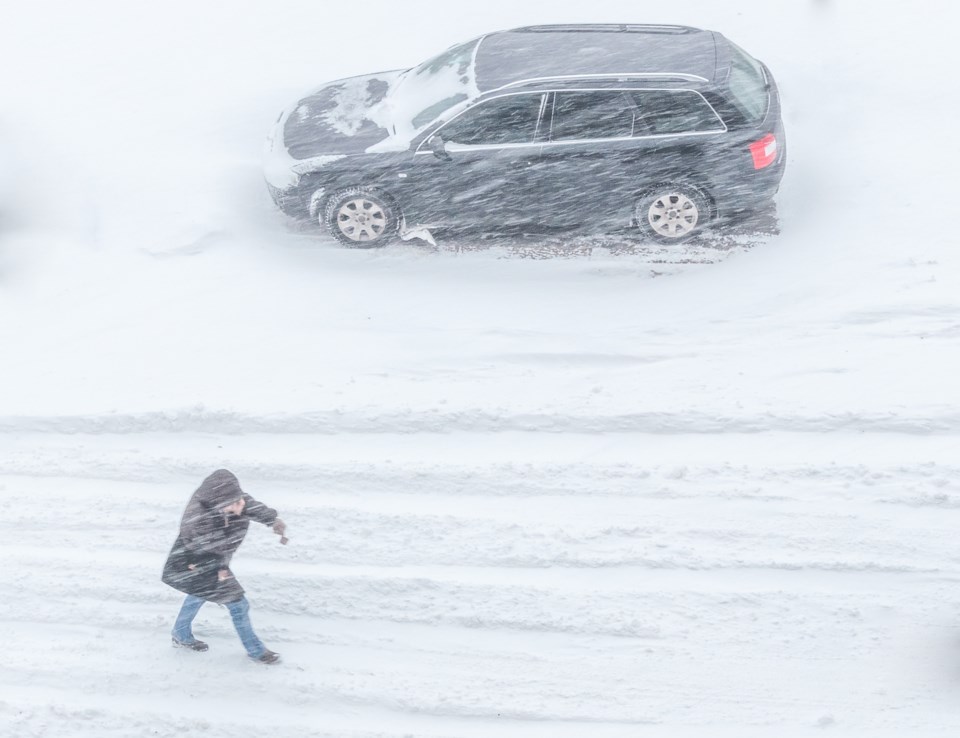
Lake effect snow bands have produced near zero visibilities at times this morning. Local snowfall amounts of 5 to 10 cm will be possible by the time snow squall activity weakens late this afternoon.
The heavy snow, combining with strong northwesterly winds gusting up to 80 km/h, will continue to produce near zero visibilities in heavy snow and blowing snow at times. Motorists should prepare for adverse winter driving conditions and adjust their travel plans accordingly.
Please continue to monitor alerts and forecasts issued by Environment Canada. To report severe weather, send an email to [email protected] or tweet reports using #ONStorm.
*****
Special weather statement in effect for:
- Sault Ste. Marie - St. Joseph Island
- Searchmont - Montreal River Harbour - Batchawana Bay
- Blind River - Thessalon
- Espanola - Killarney
- Manitoulin Island
Strong winds today.
Winds have eased from their peak last night. However, winds are forecast to strengthen again this morning, particularly along the shorelines of Whitefish Bay, North Channel and Manitoulin Island. Gusts up to 80 km/h can be expected from late morning into early afternoon. Winds will diminish by evening.
Strong winds can throw loose objects, cause tree branches to break, and damage property. Power outages are also possible.
Please continue to monitor alerts and forecasts issued by Environment Canada. To report severe weather, send an email to [email protected] or tweet reports using #ONStorm.
*************************