ENVIRONMENT CANADA
*************************
Severe thunderstorm warning in effect for:
- Sault Ste. Marie - St. Joseph Island
- Searchmont - Montreal River Harbour - Batchawana Bay
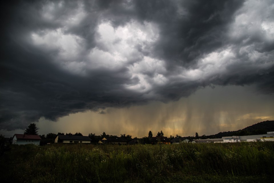
At 8:58 p.m. EDT, Environment Canada meteorologists are tracking a line of severe thunderstorms capable of producing very strong wind gusts, up to nickel size hail and heavy rain.
This line of severe thunderstorms is located from 25 kilometres southwest of Pancake Bay Provincial Park to 10 kilometres northwest of Montreal River Harbour, moving east at 60 km/h.
Take cover immediately, if threatening weather approaches. Heavy downpours can cause flash floods and water pooling on roads. Strong wind gusts can toss loose objects, damage weak buildings, break branches off trees and overturn large vehicles. Lightning kills and injures Canadians every year. Remember, when thunder roars, go indoors!
Severe thunderstorm warnings are issued when imminent or occurring thunderstorms are likely to produce or are producing one or more of the following: large hail, damaging winds, torrential rainfall.
The Office of the Fire Marshal and Emergency Management recommends that you take cover immediately if threatening weather approaches.
Please continue to monitor alerts and forecasts issued by Environment Canada. To report severe weather, send an email to [email protected] or tweet reports using #ONStorm.
For more information: http://www.emergencymanagementontario.ca/english/beprepared/beprepared.html.
Severe thunderstorm warning in effect for:
- White River - Dubreuilville
At 8:15 p.m. EDT, Environment Canada meteorologists are tracking a severe thunderstorm capable of producing very strong wind gusts, up to toonie size hail and heavy rain.
This severe thunderstorm is located 5 kilometres east of Dubreuilville, moving northeast at 50 km/h.
Locations impacted include:
Wanda.
Take cover immediately, if threatening weather approaches. Heavy downpours can cause flash floods and water pooling on roads. Large hail can damage property and cause injury. Strong wind gusts can toss loose objects, damage weak buildings, break branches off trees and overturn large vehicles. Lightning kills and injures Canadians every year. Remember, when thunder roars, go indoors!
Severe thunderstorm warnings are issued when imminent or occurring thunderstorms are likely to produce or are producing one or more of the following: large hail, damaging winds, torrential rainfall.
The Office of the Fire Marshal and Emergency Management recommends that you take cover immediately if threatening weather approaches.
Please continue to monitor alerts and forecasts issued by Environment Canada. To report severe weather, send an email to [email protected] or tweet reports using #ONStorm.
For more information: http://www.emergencymanagementontario.ca/english/beprepared/beprepared.html.
Severe thunderstorm watch issued for:
Agawa - Lake Superior Park, Ont. (048810)
Searchmont - Montreal River Harbour - Batchawana Bay, Ont. (048820)
Current details:
Thunderstorms over Lake Superior are tracking towards the area this evening. Wind gusts of 90 km/h are possible along with heavy rain.
Thunderstorms are expected to move east of the area later this evening or overnight.
Strong wind gusts can toss loose objects, damage weak buildings, break branches off trees and overturn large vehicles. Hail is also possible.
Be prepared for severe weather. Take cover immediately, if threatening weather approaches. If you hear thunder, then lightning is close enough to be dangerous.
The Office of the Fire Marshal and Emergency Management recommends that you take cover immediately if threatening weather approaches.
Severe thunderstorm watches are issued when atmospheric conditions are favourable for the development of thunderstorms that could produce one or more of the following: large hail, damaging winds, torrential rainfall.
Please continue to monitor alerts and forecasts issued by Environment Canada. To report severe weather, send an email to [email protected] or tweet reports using #ONStorm.