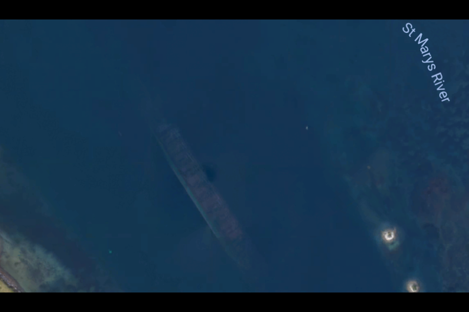
SooToday has received two Google Maps images – one from reader Luke Van Scoy, the other from the U.S. Coast Guard – showing eerie, shadowy outlines of freighters in the Sugar Island area and the Soo Locks.
“The latest Google Map update appears to show an old large sunken boat just north of the Sugar Island ferry dock. It's right in the middle of the channel - it's a wonder freighters have not been brushing up against it,” Van Scoy wrote in an email.
SooToday contacted the U.S. Coast Guard’s Sault, Michigan station Thursday.
After conducting an investigation, Sault Ste. Marie U.S. Coast Guard officer James Pillman provided another Google Maps image of a freighter at the Locks.
“From further review of the image it looks as if Google is starting to blur freighters passing through the river,” Pillman replied by email, though Pillman added U.S. Coast Guard officials are unsure as to why.
Pillman wrote the first Sugar Island image had him “triple checking charts for marked wreckage.”
So, if you spot ghostly outlines of ships on the St. Marys River on Google Maps, rest assured you’re not seeing a sunken ship or something paranormal.
It’s just the folks at Google doing their thing.