 NEWS RELEASES
MINISTRY OF NATURAL RESOURCES
The Ministry of Natural Resources – Sault Ste. Marie District is advising area residents that a Flood Warning remains in effect in the district.
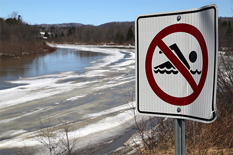
Residents of the Sault Ste. Marie District should keep a close watch on conditions, regularly check for updated messages and stay away from fast-moving rivers and streams.
Residents are advised that although water levels have dropped slightly over the weekend and some low lying areas are still experiencing flood conditions.
MNR is closely monitoring the weather and developing watershed conditions.
Further updates will be issued as appropriate.
TECHNICAL INFORMATION
Description of Weather System
Rainfall of less than 20 mm is forecast cumulatively for the next five days. Daytime high temperatures will be between 5 to 15 degrees for much of the region.
Description of Current Conditions
The snow pack within the district in some areas remains high. Most recently, streams in the Sault Ste. Marie District are rising due to recent rain and snow melt.
This trend could continue due to warm temperatures through the day in the next five days.
Some low lying areas in the communities of Goulais River and Searchmont are still experiencing flood conditions.
A close watch on local forecasts and conditions is recommended.
Expiry Date:
This message will expire on Friday, May 9, 2014, 12 a.m.
Terminology: Notification Levels
WATERSHED CONDITIONS STATEMENT - FLOOD OUTLOOK: Gives early notice of the potential for flooding based on weather forecasts calling for heavy rain, snow melt, high winds or other conditions.
WATERSHED CONDITIONS STATEMENT – WATER SAFETY: Indicates that high flows, melting ice or other factors could be dangerous for such users as boaters, anglers and swimmers but flooding is not expected.
FLOOD WATCH: Potential for flooding exists within specific watercourses and municipalities.
FLOOD WARNING: Flooding is imminent or occurring within specific watercourses and municipalities.
The Ministry of Natural Resources – Sault Ste. Marie District is advising area residents that a Flood Warning remains in effect for the Blind River system.
Residents should keep a close watch on conditions, regularly check for updated messages and stay away from fast-moving rivers and streams. Residents are advised that some areas continue to experience flood conditions.
MNR is closely monitoring the weather and developing watershed conditions.
Further updates will be issued as appropriate.
TECHNICAL INFORMATION
Description of Weather System
Rainfall of less than 20 mm is forecast cumulatively for the next five days.
Daytime high temperatures will be between 5 to 15 degrees for much of the region.
Description of Current Conditions
Streams in the Sault Ste. Marie District are rising due to recent rain and snow melt.
This trend could continue due to warm temperatures over the next five days.
Some low lying areas in the Blind River system are still experiencing flood conditions.
A close watch on local forecasts and conditions is recommended.
Expiry Date:
This message will expire on Friday, May 9, 2014, 12 a.m.
Terminology: Notification Levels
WATERSHED CONDITIONS STATEMENT - FLOOD OUTLOOK: Gives early notice of the potential for flooding based on weather forecasts calling for heavy rain, snow melt, high winds or other conditions.
WATERSHED CONDITIONS STATEMENT – WATER SAFETY: Indicates that high flows, melting ice or other factors could be dangerous for such users as boaters, anglers and swimmers but flooding is not expected.
FLOOD WATCH: Potential for flooding exists within specific watercourses and municipalities
FLOOD WARNING: Flooding is imminent or occurring within specific watercourses and
municipalities.
A close watch on local conditions and weather forecasts from Environment Canada is recommended.
Environment Canada bulletins can be found at http://weather.gc.ca/
The Surface Water Monitoring Centre public webpage can be found here: www.ontario.ca/flooding
*************************