Sault Ste. Marie City Council last night green-lighted a cycling master plan including cycling routes and other improvements expected to cost $7.9 million.
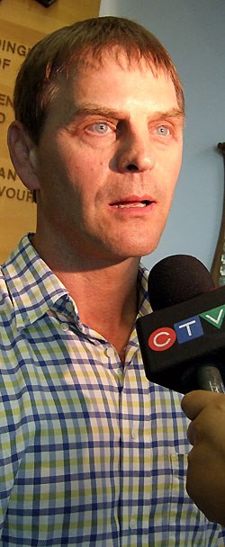
"It may seem like a lot of money but really it's not," said Sault Cycling Club President Andre Riopel.
"Many of the items that the plan calls for can be done fairly easily, for relatively little money and in a short amount of time," Riopel said. "The plan is open-ended and doesn't call for the money to be spent all at once."
Individual parts of the plan will be approved each year by councillors.
Approval will be subject to design considerations, availability of funds and environmental assessment.
The master plan was developed by the City of Sault Ste. Marie in co-operation with Sault Trails Advocacy Committee (STAC), with input received from citizens and stakeholders last month.
"The goal of the plan is to establish priority routes and design standards to encourage cycling as a viable mode of transportation and to promote recreational opportunities in the community," said an announcement for last month's open house on the City website.
Marshall Macklin Monahan (MMM) Group was hired to update its cycling master plan and Mark Inglis was at last night’s meeting to outline the plan and answer questions of Council.
STAC Committee Chair and Sault Cycling Club community cycling director Jim Miller was to have been at the meeting but he passed away on August 10, a few weeks after the open house on the plan.
At the open house in July, Miller presented a list of cycling club concerns in order of priority.
On top of that list was the downtown core.
"The conditions downtown are generally chaotic for cycling," Miller said. "Most cyclists ride on the sidewalk."
Cyclists often take to the sidewalks downtown because riding on roads designed to accommodate motorized traffic exclusively is too difficult.
"Every driveway crossing becomes an intersection and drivers often don't see cyclists on the sidewalks. They don't expect to see them there so they aren't looking for them."
The sidewalk is a place no one wants cyclists to be, said Miller, but they end up there because they believe it’s safer than the road.
"It’s always better to concede the road to a motorist than to be dead right about a right to be there," he said, arguing that the draft master plan did not adequately address opportunities for improving cycling infrastructure downtown.
Last night, however, the Cycling Master Plan Final Report accepted by City Council, did address the core area as its first priority.
The first prioroty listed was: “Route 14E: Establish cycling route on Queen Street East in the downtown core and employ traffic-calming measures such as raised intersections and loop/ cyclist activated traffic signals.
Riopel also echoed Miller's concerns about cyclist safety downtown and suggested that, in addition to recommendations in the report, traffic be slowed to 30 kilometres an hour and traffic lights be timed to keep traffic at that speed.
“The downtown should be a place where people go to, not a place they drive through,” Riopel said.
He added that the plan was probably not exactly what he would have written, but that it was a good document with a lot of things he liked.
“We haven’t solved all the problems but I’m very happy with it,” Riopel said. “Jim [Miller] would have been happy with it, too, and very proud of the work we’ve all done.”
Riopel said the things he liked most about the plan are that it recognizes that all roads are cycling routes, that it's a destinations-oriented plan and that it begins with the Hub Trail.
Additional engineering priorities:
- Establishment or improvement of cycling routes including: improvements to Landslide Road between Third and Fifth Line; reduction of Queen Street East from Pim to Daisy Road from four lanes to three with a half-lane-wide bike route on each side; establishment of a bike route on Bay Street from East to Pim Streets; and other area-specific route directives.
- Cycling initiatives including: road maintenance to improve cycling conditions and opportunities; creation of connecting links and shortcuts for cyclists; bicycle lanes on Pine and Pim Streets; multi-use trails on Second Line East and West; and other initiatives, some of which (boardwalk extension) have already started.
- Future opportunities including: mid-block crossings that help realize cycling as an integral component of transportation planning; land-use planning that is considerate of barriers to cycling; a new cycling east-west corridor that incorporates street design with bike lanes or wider curbs, possibly also incorporating Trunk Road and Wellington Streets as part of the route.