Like others in the area, the pictographs at Agawa Bay were made by Ojibwe peoples living in the area hundreds of years ago and are a part of their spiritual practices.
Their location at Lake Superior Provincial Park is called Mazinaubikiniguning, which translates to "the adorned rock on Agawa Lake." As a place of vision questing, both the paintings and the rock they are on are sacred to the Ojibwe.
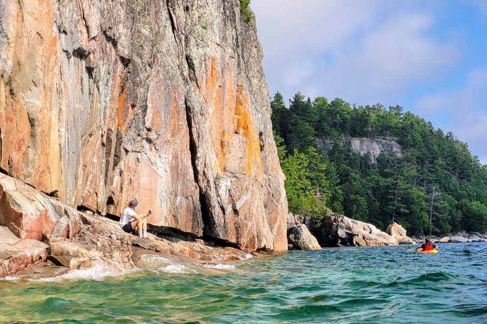
The day we visited the 15-storey white, crystalline granite cliff, the big lake was deceptively calm in Sinclair Cove at the boat launch, where we put in with our kayaks.
As we rounded the northern point of the sheltering cove, we were confronted with waves as high as two metres and coming from all directions.
With the wind at our backs we made good time (15 minutes) from Sinclair Cove to Mazinaubikiniguning, despite the waves. Coming back was another story.
We rested in and explored a couple small bays, staying hydrated and taking pictures.
Every time we left the shelter of a small bay or inlet, we were buffeted by waves and wind, left feeling like corks bobbing along the water. But it was well worth the trip to see Mishipeshu and the other pictographs.
The sound of paddles in rough waves with water slicing over the bow of the kayak almost sound the way one might imagine the voice of the great Ojibwe water lynx illustrated on the rock.
Don't wait to make this trip as the pictographs are fading.
Do check the weather before you go because access to the ledge at the bottom of the cliff may be closed if the waves are too high.
At the Lake Superior Provincial Park Visitor Centre, you can pick up a map and learn more about all eight kayak/canoe routes and 11 hiking trails maintained in the nearly 161,000-hectare park. That way, if you can't get out on Lake Superior, you can try one of the smaller lakes that are more sheltered and less rough, or go for a hike instead.
Staff at the visitor centre in Agawa Bay will likely remind you to check the marine forecast on the bulletin board when they provide you with your map. This is a very good idea, especially for novice paddlers.
Plan to spend some time at the visitor centre, too. There you will learn of area culture, history, flora, fauna, terrain and attractions.
The park, established in 1944, is generally open from May 6 to Oct. 23 for both day use and camping.
A day use parking pass purchased either online or at the visitor centre covers all parking areas in the park. There are three-day use or picnic areas in the park, one at Katherine Cove, one at Sand River and one at Old Woman Bay.
Katherine Cove and Old Woman Bay offer good beaches for swimming and picnicking while Sand River and Old Woman Bay offer access to good hiking trails that lead to spectacular views of Lake Superior, as well as bird watching and nature discovery opportunities.
There are two comfort stations in the park, one at Agawa Bay and the other at Rabbit Blanket Lake campgrounds. These include flush toilets, shower and laundry facilities.
There are more than 200 car camping sites available at two campgrounds in the park as well as numerous back country camping sites available at a variety of campsites.
These can be booked online and permits picked up in the park at one of two locations; either the visitor centre at Agawa Bay or the main office at Red Lake.