SPECIAL WEATHER STATEMENT
ENVIRONMENT CANADA
*************************
Special weather statement in effect for:
- Agawa - Lake Superior Park
- Sault Ste. Marie - St. Joseph Island
- Searchmont - Montreal River Harbour - Batchawana Bay
Much colder air with snow or freezing rain on the way.
A sharp cold front slipping southeast across the region will herald the arrival of much colder air from the Arctic.
This cold front will bring a sudden end to a mild spell.
Rain falling in the mild air ahead of the front will change over to snow in its wake, as temperatures drop fairly quickly to well below freezing.
The changeover to snow will occur this morning over northern sections such as near Kapuskasing, but not until tonight in the Sault Ste Marie to North Bay regions.
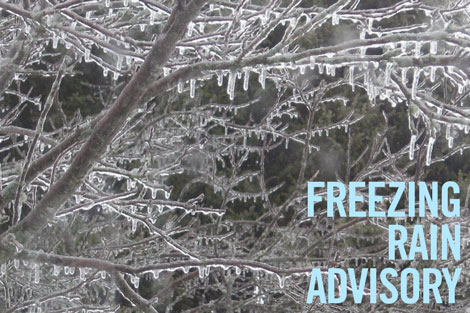
Freezing rain is quite possible during the changeover, especially in the Sudbury and North Bay areas tonight.
Freezing rain warnings may be required as the event draws closer.
Current indications suggest snowfall amounts will range from near 5 cm near the Great Lakes, to 10 to 15 cm further inland by Friday morning.
Higher snowfall amounts are expected in the Timmins and Kirkland Lake areas where snowfall warnings are in effect.
Travel is expected to become difficult at times due to winter driving conditions that could include icy roads, reduced visibility, and rapidly accumulating snow.
Motorists should allow extra time to reach their destination.
Environment Canada will continue to monitor this developing situation closely.
The public is advised to monitor future forecasts and warnings as warnings may be required or extended.
*************************